 |
|
|
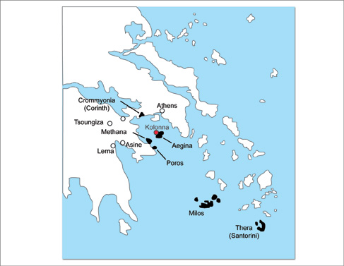
Generalized map of the Aegean mainland and islands (after Rutter, 1993). Shown in black is Aegina Island as well as other nearby volcanic centers that constitute the western end of the active South Aegean Volcanic Arc (SAVA). Note the location of Kolonna on the northwestern side of Aegina (shown in red). "Overview for Distribution Problems" POWERPOINT SLIDES |
 |
 |
 |
 |
 |
 |
 |
 |
 |
|---|
| MAPS | 1 • 2 • 3 • 4 • 5 • 6 • 7 • 8 • 9 |
| © 2009 INDIANA UNIVERSITY | LAST UPDATED April 14, 2010 | HOME • IMAGE DATABASE • FIELD WORK • SEARCHABLE DATABASE |